Showing posts with label survey. Show all posts

Friday, December 30, 2022

Billy Owen, Surveyor and Eclipse Observer by Zina Abbott


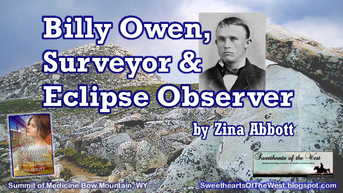
I became interested in surveyor, William Octavius “Billy” Owen, when I learned that he viewed the 1878 total solar eclipse while on the summit of Medicine Bow Mountain. I started my books that included this particular eclipse with Mail Order Blythe, published in March 2021. I will be publishing Lauren, my fifth and final book with the eclipse connection, in January 2023.

Photographs of Billy Owen are available online, but are part of a protected collection. To see two of those photos, please CLICK HERE.

The parents of Billy Owen were originally from an area near Bristol, England. Before his birth, his father and other extended members of the family joined the Church of Jesus Christ of Latter-day Saints (Mormon). Prior to his birth, his parents and six-month-old sister, Eva, emigrated to the United States. It was in Utah Territory that Billy’s next older sister, Etta, was born in 1856. Billy, the family’s youngest child, was born in 1859. The mother never did join the same church as her husband, and soon decided to leave the Salt Lake Valley and return to England.

Laramie Depot

Billy Owen never saw a railroad until he was eight years old and the family arrived in Laramie, Wyoming Territory. Laramie was still a “Hell on Wheels” town, since the railroad reached Laramie in early May, five weeks before the Owens did.

It was there his mother learned the inheritance she counted on to pay their passages back to England had disappeared after the death of the family attorney. Going by the name of Sarah Montgomery, Billy’s mother rented some rooms in a hotel on what’s now First Street in Laramie, facing the tracks, and South A. Soon she opened a restaurant and store, just as she had in Idaho. Eva and Etta, by then 15 and 12 years old, helped their mother a great deal.

There were plenty of respectable people in town, but, according to the autobiography Billy wrote when he was sixty-two, there were also plenty of “bar room bums, thugs, garroters, holdups, thieves and murderers from railroad towns to the eastward, and the doings of this mob of criminals form a thrilling page in the history of Laramie.” In that environment, Billy roamed the streets playing pranks with his friends. He roamed the creeks fishing and the prairies hunting with the same friends. They hunted with an antiquated black-powder musket out of which they would shoot gravel and nails when they ran out of bullets.

In October, the vigilantes raided the homes of three men — Asa Moore, Con Wagner (or Wager, or Wagan) and Ed “Big Ned” Wilson, shot them full of bullets, and then hanged their bodies from the end of a log building downtown.  The same night, they told a number of other toughs to leave town immediately or face the same treatment. Next morning, Billy and his pals got a long look at the bodies. They recognized Moore by his big red flannel neckerchief.

Later the same day, Billy and his friend Phil Bath were in the street when they saw a group of men come out of a saloon, one carrying a coil of rope. In the middle of the bunch was a man known to all as “Long Steve” (aka Steve Young or Steve Long), who had terrorized the town and murdered several citizens. In spite of being warned to leave town, he remained. The vigilantes hanged him on a telegraph pole near the corner of what are now Grand Avenue and First Street, which was by the tracks. A big crowd had gathered, among them Phil and Billy, who watched from 20 feet away. Billy’s sister, Eva, watched from further back in the crowd. After these incidences, Laramie became a safer place to live.


In this picture of the crowd that gathered around the deceased “Long Steve,” the lone boy standing just left of the pole is Billy Owen.

Billy grew up to be a small man, reaching a height of only five feet tall. However, he made up for his size with fierce energy and ambition. He became Wyoming’s best-known surveyor. He loved the work, both the math and the walking.


In the summer of 1878, William O. “Billy” Owen was working with a surveying crew high in the Medicine Bow Mountains, about 36 miles west of Larame Territory. “Over that vast forest,” he later wrote, “the moon’s shadow was advancing with a speed and rush that almost took one’s breath.” This was the total solar eclipse of July 29, 1878.


“It was terrifying, appalling,” Owen’s account continues, “and yet possessed a majestic grandeur and fascination that only one who has seen it can appreciate.”


Billy Owen contracted with the precursor to the Federal Bureau of Land Management. From 1881 to 1891, he did over 100 BLM surveys, particularly in the Snake River Valley around Jackson Hole and western Wyoming. He surveyed and established the boundaries of Albany County, and did surveys in every other Wyoming county. 


In addition, he held posts as Albany County Surveyor, Laramie City Engineer, and US Examiner of Surveys for the Department of Interior until his retirement in 1914.  Active in Republican politics, he was elected Wyoming State Auditor in 1894 and served four years beginning in January 1895.  Lake Owen in the Medicine Bow Mountains, which is now a reservoir and part of the City of Cheyenne’s water supply system, is probably named for him.

In 1883, Billy was the first person to ride a bicycle through Yellowstone Park. He and a party of friends were the first people to climb the Grand Teton. Mount Owen, in the Tetons, is named for him.


Billy Owen at the summit of the Grand Teton in August 1924, when he was about 65 years old and made the climb with Paul Petzoldt as guide. The painted steel sign is the same one he and companions left there in 1898. American Heritage Center.

In 1888, Billy married Emma Wilson in Laramie. He and his wife never had children. She weighed 250 pounds and loved to bake him cakes. Billy’s great niece, Alice Downey Nelson, remembered him years later as a smart, fussy man with a short temper and a long, clear memory, who loved to tell stories.

Billy Owen and Emma moved to Los Angeles in 1910. He died in 1947 in Tucson, AZ.   A manuscript copy of his 1930s autobiography and Downey family papers (his sister Eva married Stephen W. Downey) are archived at the Laramie Plains Museum.


Lauren
is the book in which I actually include the scene involving Billy and the survey crew with which he worked. It is while searching for this survey crew that my hero, Jeb Carter, also views the eclipse. 

Lauren is currently on pre-order and will be released January 9, 2023. To find the book description and purchase link, please CLICK HERE.


Sources:

https://www.wyoachs.com/people/2017/12/20/billy-owen-laramie-pioneer-surveyor-and-mountain-climber

https://www.wyohistory.org/encyclopedia/kid-hell-wheels-laramie-railroad-arrived

https://en.wikipedia.org/wiki/William_O._Owen

https://www.wyohistory.org/encyclopedia/kid-hell-wheels-laramie-railroad-arrived

Wednesday, November 30, 2022

Survey Markers by Zina Abbott


Survey markers are objects placed to mark key survey points on the Earth's surface. They are used in geodetic and land surveying.

Geodetic, or geodesy, refers to accurately measuring and understanding the earth’s geometric shape and size, its orientation in space, and gravity.  As for land surveying, this becomes necessary—not only to create more accurate maps, including topographical maps, but also to mark off land boundaries.


Survey markers are used to mark national and state boundaries, such as this 1877 marker on the Arkansas-Oklahoma state line.


This survey marker was originally upright. It marked the eastern 1893 Oklahoma Land Run boundary.


A benchmark is a type of survey marker that indicates elevation (referring to a vertical position). Horizontal position markers used for triangulation are also known as triangulation stations. Considering the earth is a globe, not flat, and contains mountains and valleys, these details must be accounted for through triangulation.


Survey markers are also called survey marks, survey monuments, or geodetic marks. My husband, who worked almost his entire career in one aspect or another of engineering construction, called them shiners.


This particular shiner is next to Merced River inside Yosemite National Park, just after entering the toll gate on Highway 140. There is a small rest stop there. While waiting for me one year, he wandered out over the rock that overlooked the river and was pleased to find this shiner firmly embedded in the stone.

1855 Geodetisch station at Ostend, Belgium used for triangulation

Survey markers were often placed as part of triangulation surveys, measurement efforts that moved systematically across states or regions, establishing the angles and distances between various points. Such surveys laid the basis for map-making across the world. 

Located on peak of Prospect Hill-Wompatuck State Park, Hingham, MA
 

All sorts of different objects, ranging from the familiar brass disks to liquor bottles, clay pots, and rock cairns, have been used over the years as survey markers. 

Some show the meeting points of three or more countries. In the 19th century, these marks were often drill holes in rock ledges, crosses or triangles chiselled in rock, or copper or brass bolts sunk into bedrock. 


 Today in the United States, the most common geodetic survey marks are cast metal disks with stamped legends on their face set in rock ledges,


embedded in the tops of concrete pillars,or affixed to the tops of pipes that have been sunk into the ground. These marks are intended to be permanent, and disturbing them is generally prohibited by federal and state law.


Some old markers were buried several feet down to protect them from being struck by ploughs or disturbed by other means. Occasionally, these buried marks had surface marks set directly above them.

This year, it was my research for two books set in the new Oklahoma Territory that was formed as a result of the land runs that led to my research on survey markers.

In 1871, the internal format of Oklahoma, then the Indian Territory, began to take shape. Based on Thomas Jefferson's standard United States public land survey system of townships, ranges, sections and quarter sections, an Initial Point was selected and a grid work of north-south and east-west lines was established. The entire Indian Territory was surveyed from a "bearing point" located one mile south of Fort Arbuckle and eight miles west of present-day Davis.

Survey crew Cherokee Strip (Outlet)

I have not discovered exactly what style of survey marker was used when the Cherokee Outlet was divided into quarter sections or city lots for those new cities that were planned in preparation for the 1893 land run. I’m sure they were set in a manner to avoid being disturbed or removed. 

However, in my book, Joshua’s Bride, my fictional heroine, Rose Calloway, attempted to secure the survey marker on the back, out of the way corner of the homestead plot she claimed. Being told by two of her neighbors who shared the corner that it was illegal for her to remove the survey marker did not deter her from digging it up. She was determined to keep usurpers from coming onto the back portion of her land and copying down the coordinates in an effort to claim the homestead plot for themselves. Here is an excerpt from the book:

         “You need to put it back, right away. In fact, give it me. I’ll find a surveyor and have him reset it.” The clerk reached for the pole.

         “No!” Rose twisted to keep the post away from his reach. “It’s my pole that goes to my property. Well, mine and three of my neighbors.”

         “Sir, you won’t need to go to all that trouble.” Joshua pulled Rose behind him and stepped to squarely face the clerk. This woman needs a keeper. “She’s with me, and I’ll help her return it where it goes.”

         “She your wife?”

         “No, sir, she’s my fiancé. We have one more matter of business to see to while we’re here, and then I’ll return her home and help her reset it.” The word fiancé was out of Joshua’s mouth before he even thought about it. He did not know how she felt about it, but, he reasoned, it was better for her reputation to be traveling in the company of a fiancé than a man with whom she had a casual acquaintance. He held the clerk’s gaze.

         “Is there a problem, Charlie?” A deep voice sounded as an older, thick-shouldered man with a deputy marshal’s badge on his chest approached.

         “This woman here—” The sputtering clerk waggled a finger at Rose as he turned his head to toward the deputy marshal.

         “There’s just been a little misunderstanding, marshal.” With a smile that lit her entire face, Rose stepped back to Joshua’s side. “I brought this survey post with me to help me register my land. You know, to prove I am the one who has the claim on that particular homestead? However, the clerk just told me I wasn’t supposed to take it out of the ground. I assured him I will take it home and put it back where it goes.”

         Joshua shifted his gaze between Rose, the deputy marshal with the thoughtful expression, and the clerk, who rolled his eyes. He resisted the urge to roll his eyes, too. I want to be her keeper. He cleared his throat. “As I was telling this gentleman, here…” he gestured toward the clerk. “Now we know the pole needs to stay in place, we’ll leave as soon as we finish one more item of business and go directly to the property where this survey post goes. I’ll help her get it set in the ground properly.”

         “Sounds reasonable to me.” His hands on his hips, the deputy marshal pressed his lips together and nodded. “Work for you, Charlie?” He turned to the clerk with an expression that did not invite a challenge.


         As he stared at the deputy marshal, Charlie swallowed. “If you say so.” Then he stiffened his posture as he turned and scowled at Rose. “Swear you’ll put it back as soon as you return to the property.”

         “I don’t swear, sir.” Rose straightened her spine and lifted her chin. “But, I will promise. I will return home and put the pole back where I found it.”

Joshua’s Bride is available for sale as an ebook and a paperback. It is also available at no additional cost with a Kindle Unlimited subscription. You may find the book description and purchase link by CLICKING HERE


         Rose’s sister, Marigold Calloway, claimed two lots in the town of New Ponca that was created as part of the same 1893 Cherokee Outlet Land Run. Even the boundaries of many town lots are marked with survey markers. You may find the book description and purchase link of Marigold by CLICKING HERE


Sources:

https://en.wikipedia.org/wiki/Survey_marker

https://libraries.ok.gov/state-government/corner-monuments/

https://en.wikipedia.org/wiki/1877_survey_marker_48


Saturday, June 10, 2017

Land! by E. Ayers


I've covered tiny things that affected everyday life. So this time I thought maybe I would write about something really BIG that also had a bearing on the lives of those who went west. It was the land itself. Who owned it, what was there, and how it could be settled.
           The land was totally wide-open, raw land, except the government owned the land. (Yes, you could argue that the Am. Indians owned the land, but they believed there was no ownership - it was there for them to use.) A large chunk of our western lands was obtained from France in the Louisiana
Purchase of 1803. Most of the land beyond that portion was owned by Spain. Eventually we owned what is now known as the contiguous United States. I'd say it was a slow process, but not really. A hundred nine years, after the Louisiana Purchase, to create the 48 States is relativity fast when you look at history. The land after being purchased was surveyed and marked in neat squares creating boroughs or counties. (Well, until the land wasn't as easily divided because of mountains, etc., and by then, the government was running out of money to have the land surveyed.)
Quite a bit changed in the course of those years, and we needed a faster way to travel to the west. The government decided that we needed to build railroads, they began to divide the land based on where they thought the railroads should go. Then that land was allocated and eventually "sold" to the railroads. (Only the surface land and not what was under it.) But to prevent congestion of settlers (don't laugh) along those railroad lines, the government granted the right for the railroads to own the land, but they only owned every other square of land. And the squares were laid like a checkerboard. So, in theory, the railroad owned a square on this side of the track and the government owned the other side of that track, only to switch every few miles.
People moving west, once this land was subdivided, were allowed to homestead on the government squares, but not on the railroad squares. Each checkerboard square was 10 square miles and a square was granted to the railroad for every mile of track they built. Sounds like they were given the squares after they built the tract. Well, maybe in some places, but for the most part it was already laid out and allocated before the railroad tracks were started.
The government made some decisions about where the tracks should go, which size rails to use (that determined the type of locomotive and cars on those tracks), what steel to use, how steep the grades should be, and the number of degrees a curve could have. In today's world, it sounds sensible, but back then it forced standardization because wheels and tracks were different, and provided some of the first safety features. Then railroads were "loaned" money to build the tracks. The more difficult it would be to lay the track through areas of land where there were mountains, rivers, or hills, the more money they were given. Speculation on railroads became a major investment opportunity because in theory the railroads could make huge profits. People made fortunes or lost them. But these tracks often weren't constructed as quickly as our government thought they would be. Many railroad companies went belly-up because the cost for them to lay the tracks far exceeded any estimates.
There are tons of early maps showing railroads cross-crossing the land. What they really show is what is supposed to be there. Since the railroad wanted to build an additional rail line through Wyoming, they were offered these lands in a series of checkerboard squares. Surprise! That railroad wasn't built until well into the 1900's because it wasn't worthwhile for the railroad to actually spend the money to build it. The rail line was started several times and abandoned several times. But the railroad had the land and they sold that land to raise the money to pay the government back for that amazing loan. (Are you confused yet?)
Honestly I was so confused that it took a historian from BNSF to straighten it out for me. But I was looking at a map with the railroad on it. And the Internet was populated with the old maps showing that railroad. How could it not be there? It was merely proposed, and the land granted to the railroad much like our right-of-way today. (That right-of-way might look like a road on the map, but it's not really anything and might have trees growing in the center of it.)
We made the whole situation worse when the Yankees decided to squelch the Rebel forces during the Civil War by destroying the railroad tracks in the South. Some of those tracks took forever to rebuild, while others were quickly replaced after the War. So in the late 1860's, it looked like the railroads existed on maps, but they didn't. Money was spent on the railroads that had been destroyed during the War, thus taking away money from company funds that had been allotted to build railroads out west.
It took a large number of laborers to build these lines. These guys worked horrible hours and under even worse conditions. Yes, the Chinese, working west to east, laid a great deal of the tracks, but so did plenty of other people. Why? Because many were new immigrants often chasing the American Dream and many laborers couldn’t find work where they had been living. It was honest work with what was considered good wages for those days. Okay, it was lousy pay for a dangerous job with long hours, and they were doing it in horrendous heat and freezing cold. But they did it. It was a job and they were happy to have it. They lived in moveable tent cities with only basic amenities. As companies folded, failed, or whatever, many of these workers stayed where they were and homesteaded, because they were in the middle of nowhere with no funds.
The Homestead Act of 1860 gave the homesteader 160 acres. That really wasn't enough for people to raise cattle, so they turned them loose on government property and allowed them to graze freely during the summer. If someone had enough money, they could purchase a "square" This was actually a much smaller square than those railroad checkerboard squares, those railroad squares are 10 miles squared, and a simple square within that larger square is 1 mile by 1 mile. A square mile is 640 acres. So the homesteader of 160 acres was only homesteading a fourth of that one-square mile.
Many homesteaders were wise to the system and homesteaded on government land with nearby prairie but also next to railroad land. They bought the railroad land for a cheap price, because the railroads were frequently broke and in need of cash flow. Someone with money could take the homestead acreage and purchase quite a few one-mile squares from the railroad giving them a very large chunk of land.
The real kicker here is there was quite a bit of corruption going on in the lawless West, and buying land from the railroads was actually safer than buying land from the government. Frequently, the government really didn't know what they owned. But the railroads tended to keep accurate records. They knew exactly what they owned and where! It took until almost 1910 for the government to begin to settle who owned what. Too many people who bought land from the government had their money stolen by corrupt government agents and the papers were never actually filed with the government. Or they were filed and lost, or a fire wiped out the records. It was a huge mess. And the landowners were forced to prove what they had paid, and what had been homesteaded, including the dates.
The next big question is how did they know how much land they were homesteading? There weren't too many surveyors out west and those that were worked for the railroads. Besides a surveyor would have been expensive and the average homesteader had very little money. They marked the land themselves. They used chains, ten feet long between the first and last link. They started at a spot that was identifiable, often a tree or a large rock but frequently they started at a surveyor's mark on the corner of one of those county squares. They would pound the first stake into the ground, hook the chain over it, and stretch it out. They put a stake where the chain ended. Without removing that second stake they would swing the chain and drop the next stake. They had to pound a fence post into the hole that was made with the stake. And so it went for the perimeter of their 160 acres. It was a long, hard job, and they had to keep the line straight. (That's geometry, and I'm not going to explain it. I also seriously doubt that many settlers went to that much trouble. They merely sighted the fence line.)
Homesteading was fraught with problems beyond trying to create a house out of nothing, having clean water, and growing crops where there were none. We are rather spoiled today. We call the realtor, say we like that piece of property, a few people wave magic wands, and several weeks later, we receive a copy of the deed. Someone else has already surveyed the land, guaranteed that the house is sound, and the property actually has a clean title. I'm so glad I don't have to go out there with a mallet, a chain, a few spikes, and a shovel.

Ebook on pre-order for 99c

A Rancher's Request

Zadie Larkford, recently graduated from an Eastern women’s college, lives a quiet life in her hometown of Franklin, Virginia. Content to spend her days painting by the river and watching her friends marry, she is shocked to learn that her father has promised her hand in marriage to a complete stranger. Ultimately unable to disobey, she leaves her childhood home to travel – unaccompanied – to Creed’s Crossing, Wyoming to meet her betrothed.
Raised in a seafaring community in North Carolina, Duncan Lorde made the decision to leave his father’s prosperous fishing venture to make a life for himself in the west. Determined to succeed in the treacherous and unpredictable pursuit of cattle ranching, he has land, a small cabin, and a herd. All he needs now is a wife–a good woman who will cook, clean, and provide him with strong sons to help on the ranch. When Zadie arrives in Creed’s Crossing, the young daughter of his father’s old friend is far more independent and strong-willed than he expected.
The young would-be couple has barely begun to forge a bond when the forces of man and nature collide, impeding Duncan and Zadie as they struggle to fulfill … A Rancher’s Request.